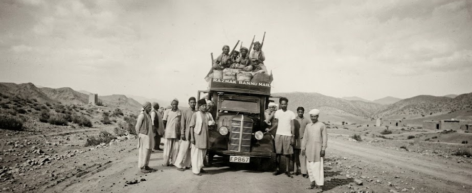
History of Bannu
Bannu is a region in Pakistan with evidence of human settlement dating back over 3,000 years, including ancient archaeological sites such as Akra, and it continues to be inhabited in modern times.
بنوں کی تاریخ
بنوں پاکستان کا ایک ایسا علاقہ ہے جہاں انسانی آبادکاری کے شواہد تین ہزار سال سے زائد پرانے ہیں، جن میں آکرہ جیسے قدیم آثارِ قدیمہ کے مقامات شامل ہیں، اور یہ آج بھی آباد ہے۔
In This Page
Ancient Times
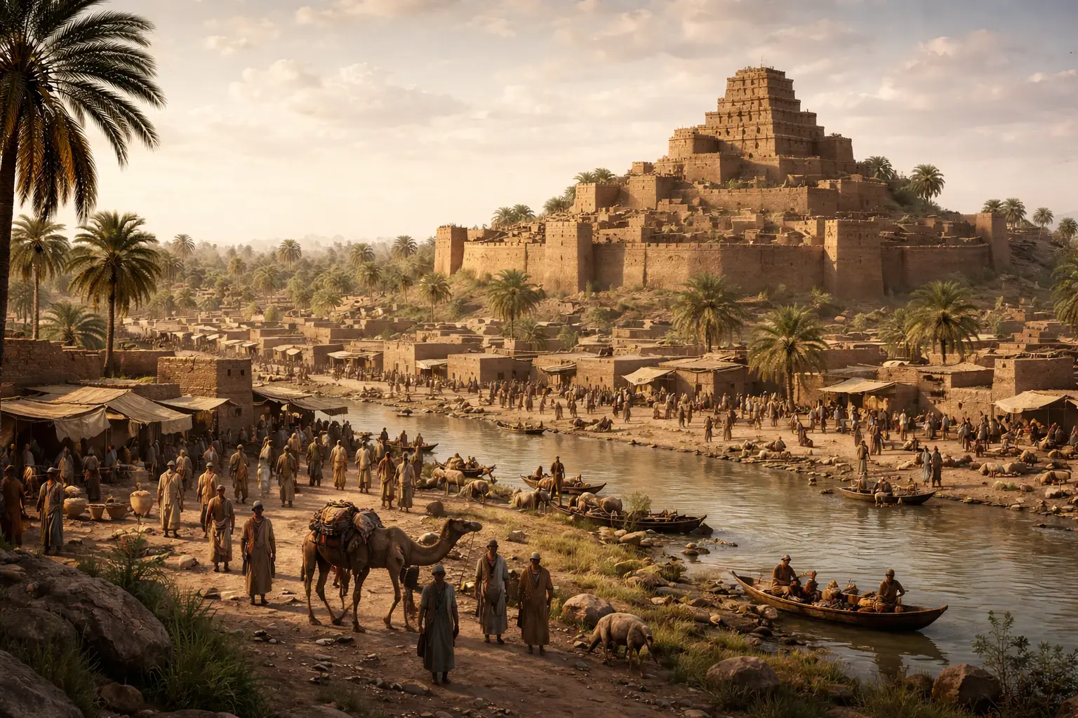
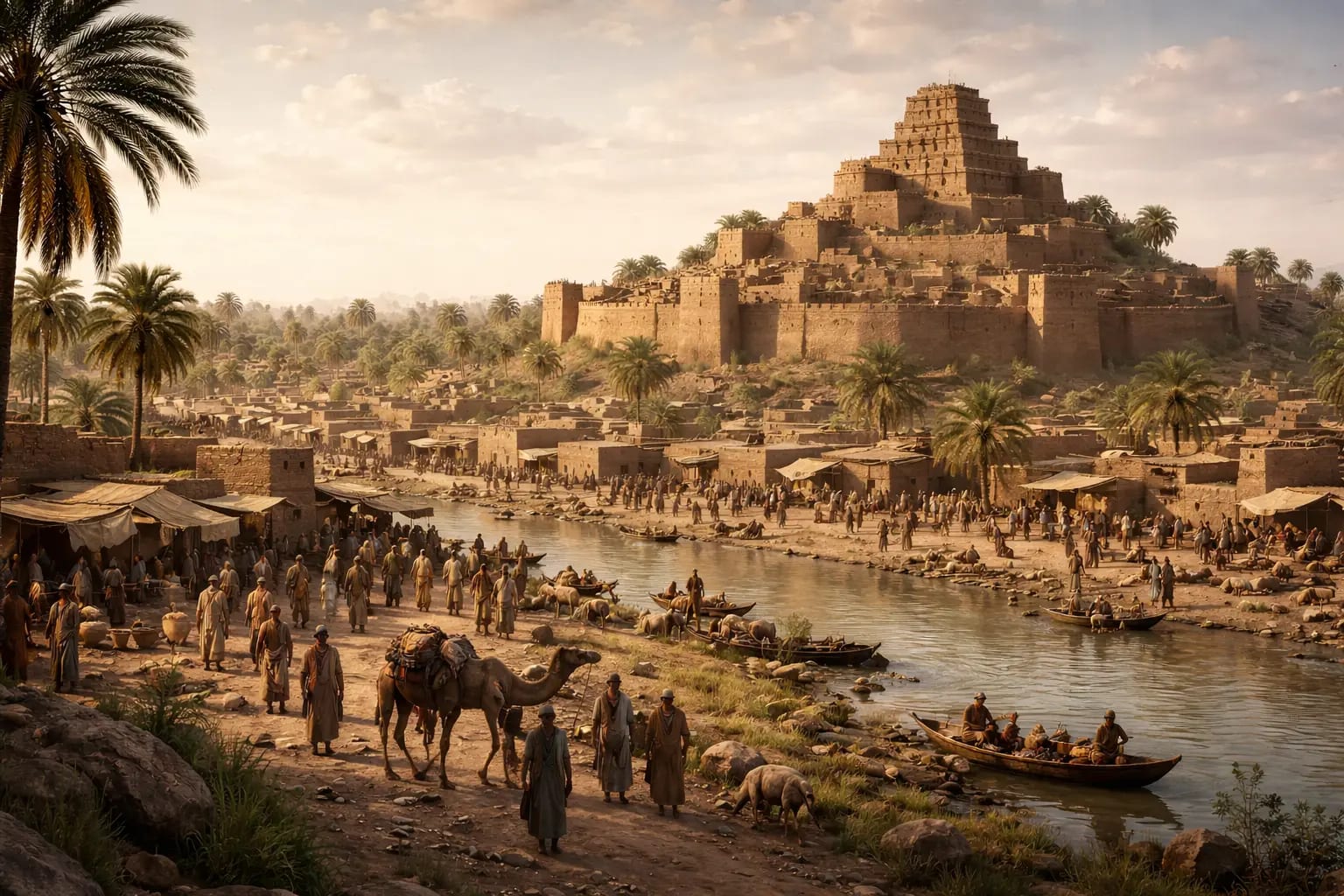
The history of Bannu is not just a local chronicle; it reflects a long and significant human history in the region. Archaeological evidence suggests that the area has been inhabited for over 3,000 years.
Akra: An Ancient Settlement
Historical Significance
Dating back to approximately 1000 BCE, Akra appears to have been a developed settlement, based on archaeological findings.
A Link to the Past
Excavations have revealed ancient pottery, coins, and artifacts that suggest cultural influences from nearby regions, including the Indus Valley and Gandhara civilizations. The area may have served as a local trade and transit point for caravans traveling between Central Asia and the Indian Subcontinent.
Etymology and Historical Names
Bannu's identity has evolved through various names recorded by world travelers and historians.
Bannah / Ban-na
The 7th-century Chinese monk and traveler Xuanzang visited regions of present-day northwestern Pakistan. While his accounts provide valuable insights into the area’s geography and culture, there is no clear evidence that he directly referred to Bannu as “Bannah.”
The Ancient Roots
Some historians trace the name to ancient Sanskrit texts, while others believe it evolved from the tribal lineages that settled in the Bannu. Regardless of the spelling — be it Bannah, Bunnoo, or Bannu — the name has always stood for a lush, green gateway protected by rugged mountains.
A Land of Legends
The region of Bannu has witnessed the influence of several historical empires, including the Ghaznavids and Mughals, as part of the broader movements across South Asia. Its fertile plains have supported agriculture for centuries, making it a continuously inhabited and regionally significant area.
قدیم دور
بنوں کی تاریخ محض ایک مقامی روایت نہیں بلکہ اس علاقے کی ایک طویل اور اہم انسانی تاریخ کی عکاسی کرتی ہے۔ آثارِ قدیمہ کے شواہد بتاتے ہیں کہ یہ علاقہ تین ہزار سال سے زائد عرصے سے آباد ہے۔
آکرہ: ایک قدیم بستی
تاریخی اہمیت
آثارِ قدیمہ کی دریافتوں کے مطابقآکرہ تقریباً 1000 قبل مسیح میں ایک ترقی یافتہ بستی معلوم ہوتی ہے۔
ماضی سے ایک رشتہ
کھدائیوں سے قدیم برتن، سکے اور دیگر نوادرات دریافت ہوئے ہیں جو وادیٔ سندھ اور گندھارا سمیت قریبی علاقوں کے ثقافتی اثرات کی نشاندہی کرتے ہیں۔ ممکن ہے کہ یہ علاقہ وسطی ایشیا اور برصغیر کے درمیان سفر کرنے والے قافلوں کے لیے ایک تجارتی اور راہداری مرکز رہا ہو۔
لفظی اصل اور تاریخی نام
بنوں کی پہچان مختلف ناموں کے ذریعے تشکیل پاتی رہی ہے جنہیں دنیا بھر کے سیاحوں اور مورخین نے قلم بند کیا۔
بنّہ / بن نا
ساتویں صدی عیسوی کے چینی راہب اور سیاح ژوان زانگ نے موجودہ شمال مغربی پاکستان کے علاقوں کا دورہ کیا۔ اگرچہ ان کی تحریریں اس علاقے کی جغرافیائی اور ثقافتی صورتحال کے بارے میں قیمتی معلومات فراہم کرتی ہیں، لیکن اس بات کا واضح ثبوت موجود نہیں کہ انہوں نے براہِ راست بنوں کو "بنّہ" کہا ہو۔
قدیم جڑیں
بعض مورخین اس نام کا سراغ قدیم سنسکرت تحریروں سے لگاتے ہیں، جبکہ دیگر کے نزدیک یہ نام بنوں میں آباد ہونے والے قبائلی سلسلوں سے وجود میں آیا۔ چاہے ہجے بنّہ ہو، بنّو ہو یا بنوں — یہ نام ہمیشہ سرسبز میدانوں اور ناہموار پہاڑوں کے پہرے میں واقع ایک ہرے بھرے دروازے کی علامت رہا ہے۔
داستانوں کی سرزمین
بنوں کے علاقے نے غزنویوں اور مغلوں سمیت کئی تاریخی سلطنتوں کا اثر برصغیر کی وسیع تر تحریکوں کے حصے کے طور پر دیکھا ہے۔ اس کے زرخیز میدان صدیوں سے زراعت کو سہارا دیتے آئے ہیں، جس کی وجہ سے یہ ایک مسلسل آباد اور علاقائی طور پر اہم خطہ رہا ہے۔
Medieval Period
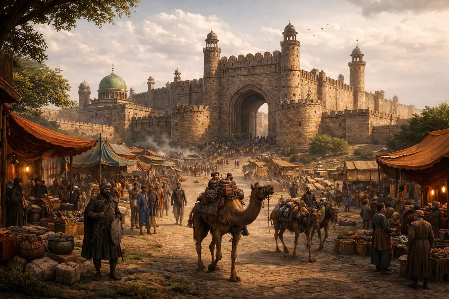
During the medieval period (roughly 1000 CE to 1800 CE), the region of Bannu developed as an area of strategic importance within broader regional movements and settlements.
The Islamic Conquests & The Ghaznavids
At the beginning of the 11th century, the region came under the influence of the Ghaznavids during their expansion into South Asia, which contributed to cultural and political changes in the wider area.
The Arrival of the Bannuchi Tribes
The Bannuchi (Bannuzai) tribes are believed to have migrated from the Shawal mountains between the 14th and 15th centuries and gradually settled in the region, shaping its social and agricultural development.
Mughal and Durrani Influence
Bannu's strategic importance made it a mandatory stop for emperors.
The Baburnama
In 1505, the first Mughal Emperor Babur marched through the Bannu. In his memoirs, he describes the region's fertility and the resistance of the local tribes.
The Durrani Empire
By the mid-18th century, Bannu became part of the Durrani Empire under Ahmad Shah Abdali. Bannu provided revenue and soldiers to the Afghan crown, though the tribes maintained a high degree of internal autonomy.
قرونِ وسطیٰ کا دور
قرونِ وسطیٰ کے دور میں (تقریباً 1000ء سے 1800ء تک) بنوں کا علاقہ وسیع تر علاقائی تحریکوں اور آبادکاری کے تناظر میں ایک اسٹریٹجک اہمیت کے حامل خطے کے طور پر ابھرا۔
اسلامی فتوحات اور غزنوی دور
گیارہویں صدی کے آغاز میں یہ علاقہ غزنویوں کے زیرِ اثر آیا جب وہ برصغیر میں اپنی سلطنت کو وسعت دے رہے تھے، جس سے وسیع تر خطے میں ثقافتی اور سیاسی تبدیلیاں رونما ہوئیں۔
بنوچی قبائل کی آمد
خیال کیا جاتا ہے کہ بنوچی (بنوزئی) قبائل چودھویں اور پندرہویں صدی کے درمیان شوال کے پہاڑی سلسلے سے ہجرت کر کے آئے اور بتدریج اس علاقے میں آباد ہو گئے، جس نے اس کی سماجی اور زرعی ترقی کو تشکیل دیا۔
مغل اور درانی اثرات
بنوں کی اسٹریٹجک اہمیت نے اسے بادشاہوں کے لیے ایک لازمی پڑاؤ بنا دیا۔
بابر نامہ
1505ء میں پہلے مغل بادشاہ بابر نے بنوں کے راستے پیش قدمی کی۔ اپنی یادداشتوں میں وہ اس علاقے کی زرخیزی اور مقامی قبائل کی مزاحمت کا ذکر کرتے ہیں۔
درانی سلطنت
اٹھارہویں صدی کے وسط تک بنوں احمد شاہ ابدالی کے دورِ حکومت میں درانی سلطنت کا حصہ بن گیا۔ بنوں نے افغان تاج کو محصول اور فوجی مہیا کیے، تاہم قبائل نے اپنی داخلی خودمختاری کافی حد تک برقرار رکھی۔
British Colonial Era
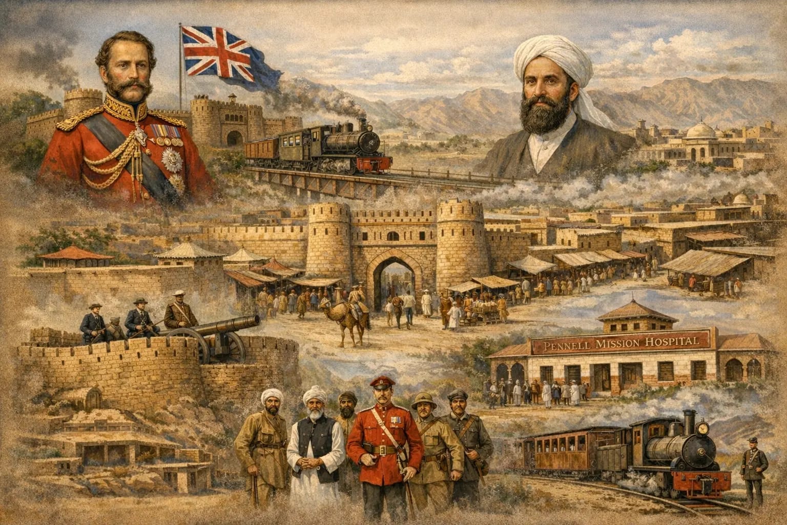
The 19th century brought a radical transformation to the valley. Following the Second Anglo-Sikh War in 1849, the British Empire annexed the Punjab, including Bannu. The region was viewed as a critical "Frontier District," essential for the defense of British India against tribal incursions and the "Great Game" involving Russia.
The Foundation by Herbert Edwardes
The modern city was founded in 1848 by Lieutenant (later Sir) Herbert Edwardes. Before his arrival, the valley consisted of hundreds of scattered, fortified villages (Kots).
The Walled City
Edwardes consolidated the administration by building a new, centrally planned town. It was originally named Edwardesabad in his honor.
The Ten Gates
The city was famously enclosed by a thick wall with ten gates (such as Lakki Gate, Kasaban Gate, Mandan Gate, Miryan Gate, and Hinjal Gate), some of which still serve as major landmarks today.
Fort Dhulipgarh
To maintain military control, Edwardes built a massive fort named Dhulipgarh (in honor of the young Sikh Maharaja Duleep Singh), which later became the heart of the Bannu Cantonment.
Modernization and Institutions
The British era introduced infrastructure that shaped the city's intellectual and physical landscape.
Education & Healthcare
The arrival of Dr. Theodore Pennell in the late 19th century led to the establishment of the famous Pennell High School and a mission hospital, making Bannu a hub for learning and medicine in the frontier.
The Narrow-Gauge Railway
The British connected Bannu to the rest of India via a strategic narrow-gauge railway line from Kalabagh (Mari-Indus), primarily to transport troops and supplies to the frontier.
Strategic Frontier Role
Bannu served as the base of operations for the Waziristan Campaigns. The Cantonment was designed with wide boulevards and colonial-style bungalows, creating a sharp contrast with the dense, traditional architecture of the "Old City."
برطانوی نوآبادیاتی دور
انیسویں صدی نے اس وادی میں ایک بنیادی تبدیلی لے آئی۔ 1849ء کی دوسری اینگلو سکھ جنگ کے بعد برطانوی سلطنت نے پنجاب سمیت بنوں کو اپنے ساتھ ملا لیا۔ اس علاقے کو ایک اہم "سرحدی ضلع" سمجھا جاتا تھا جو قبائلی حملوں اور روس کے ساتھ جاری "گریٹ گیم" کے مقابلے میں برطانوی ہندوستان کے دفاع کے لیے ناگزیر تھا۔
ہربرٹ ایڈورڈیز کے ہاتھوں بنیاد
جدید شہر کی بنیاد 1848ء میں لیفٹیننٹ (بعد ازاں سر) ہربرٹ ایڈورڈیز نے رکھی۔ ان کی آمد سے پہلے یہ وادی سینکڑوں بکھرے ہوئے قلعہ بند دیہات (کوٹوں) پر مشتمل تھی۔
فصیل بند شہر
ایڈورڈیز نے ایک نیا، مرکزی منصوبہ بندی کے تحت شہر تعمیر کر کے انتظامیہ کو مستحکم کیا۔ ابتدا میں اس کا نام ان کے اعزاز میں ایڈورڈیز آباد رکھا گیا۔
دس دروازے
شہر کو ایک موٹی فصیل نے گھیرے میں لے رکھا تھا جس میں دس دروازے تھے (جیسے لکی گیٹ، کاسبان گیٹ، منڈان گیٹ، میریاں گیٹ اور ہنجل گیٹ)، جن میں سے کچھ آج بھی اہم نشانات کے طور پر موجود ہیں۔
قلعہ دلیپ گڑھ
فوجی کنٹرول برقرار رکھنے کے لیے ایڈورڈیز نے ایک بڑا قلعہ تعمیر کیا جسے نوجوان سکھ مہاراجہ دلیپ سنگھ کے اعزاز میں دلیپ گڑھ کا نام دیا گیا، جو بعد میں بنوں چھاؤنی کا مرکز بن گیا۔
جدت اور ادارے
برطانوی دور نے ایسا انفراسٹرکچر متعارف کرایا جس نے شہر کے علمی اور تعمیراتی منظرنامے کو تشکیل دیا۔
تعلیم اور صحت
انیسویں صدی کے آخر میں ڈاکٹر تھیوڈور پینل کی آمد کے نتیجے میں مشہور پینل ہائی اسکول اور ایک مشنری اسپتال قائم ہوا، جس نے بنوں کو سرحدی علاقے میں تعلیم اور طب کا مرکز بنا دیا۔
تنگ پٹڑی ریلوے
انگریزوں نے کالاباغ (میری انڈس) سے ایک اسٹریٹجک تنگ پٹڑی ریلوے لائن کے ذریعے بنوں کو بقیہ ہندوستان سے جوڑا، جس کا بنیادی مقصد سرحد تک فوج اور سازوسامان کی ترسیل تھا۔
اسٹریٹجک سرحدی کردار
بنوں وزیرستان کی مہموں کے لیے آپریشنز کا مرکز رہا۔ چھاؤنی کو کشادہ سڑکوں اور نوآبادیاتی طرز کے بنگلوں کے ساتھ ڈیزائن کیا گیا تھا، جو "پرانے شہر" کے گنجان روایتی طرزِ تعمیر سے واضح تضاد پیدا کرتا تھا۔
Post-Independence Era: Growth & Resilience
With the birth of Pakistan in 1947, Bannu entered a new chapter as a vital part of the North-West Frontier Province (now Khyber Pakhtunkhwa). The city transitioned from a military-centric British town to a center of civic life, education, and regional commerce.
Infrastructure and The Green Revolution
Post-1947, the government focused on the agricultural potential of the Kurram and Gambila rivers.
The Kurram Garhi Project
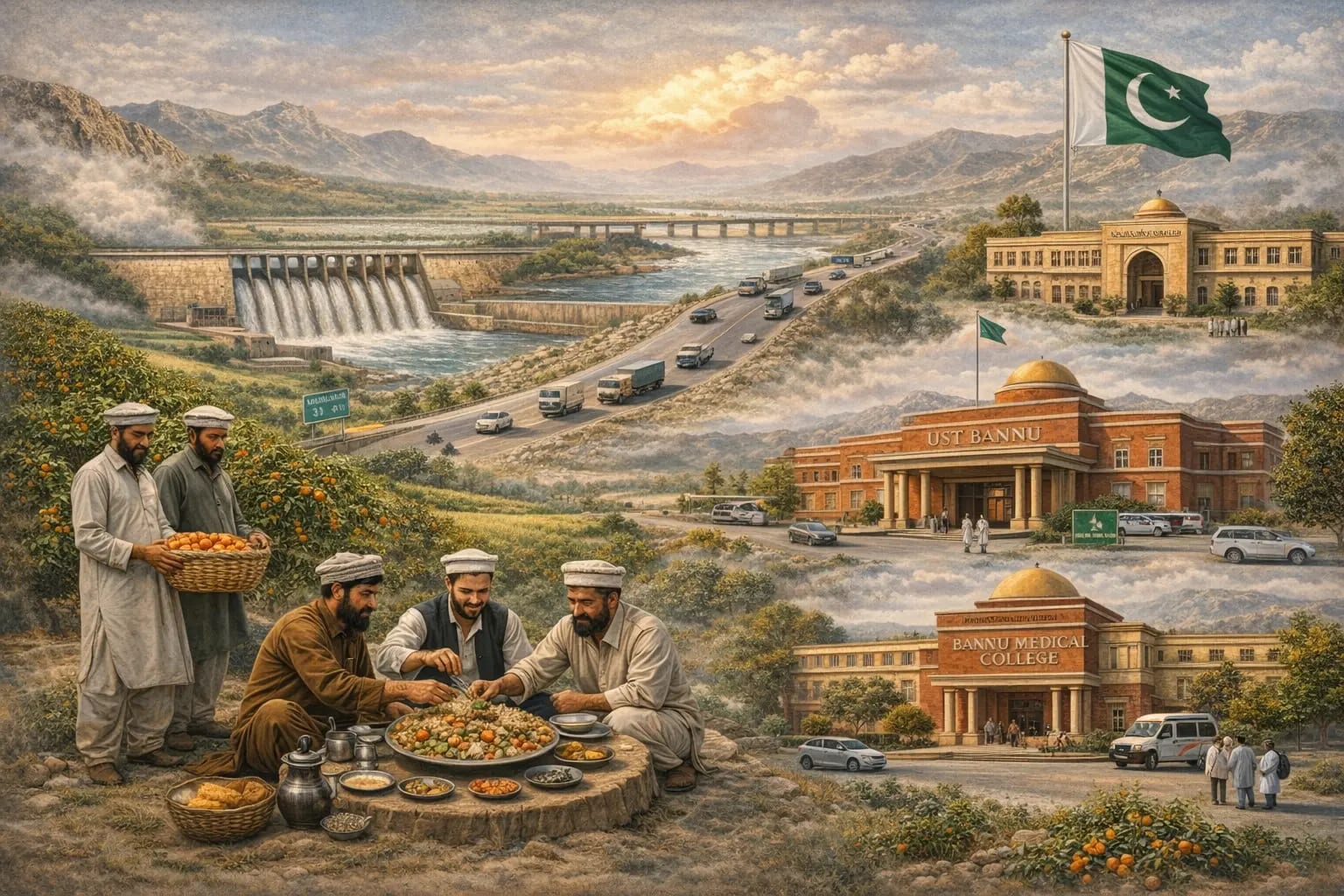
One of the most significant early developments was the construction of the Baran Dam in the 1950s. This project revolutionized local farming, turning the surrounding arid lands into the lush, fertile orchards for which Bannu is famous today.
Connectivity
The city evolved into a major transit point. As the "Gateway to Waziristan," the development of the Indus Highway and local road networks cemented its status as a vital trade link between the southern districts and the rest of the country.
The Educational Revolution
Bannu has emerged as an intellectual powerhouse in the province.
UST Bannu & Medical Education
The establishment of the University of Science and Technology (UST) Bannu in 2005 and the Bannu Medical College marked a turning point, providing world-class education to the youth of the southern districts.
Legacy Schools
Institutions like Government Post Graduate College Bannu (established in 1951) have produced generations of scholars, bureaucrats, and leaders.
Cultural Preservation & Modern Identity
Despite rapid urbanization, the soul of Bannu remains deeply rooted in Pashtunwali (the Pashtun code of conduct).
Bannuchi Hospitality
The city is celebrated for its unique traditions, such as the famous Bannu Pulao and Painda, which have become culinary symbols of the region across Pakistan.
Resilience
Throughout the turbulent decades of the early 21st century, the people of Bannu showed immense resilience, serving as a sanctuary and a support system for the surrounding tribal regions during times of displacement and conflict.
آزادی کے بعد کا دور: ترقی اور استقامت
1947ء میں پاکستان کے قیام کے ساتھ ہی بنوں نے صوبہ سرحد (موجودہ خیبر پختونخوا) کے ایک اہم حصے کے طور پر ایک نئے باب میں قدم رکھا۔ شہر ایک فوجی نوعیت کے برطانوی قصبے سے شہری زندگی، تعلیم اور علاقائی تجارت کے مرکز میں تبدیل ہو گیا۔
بنیادی ڈھانچہ اور سبز انقلاب
1947ء کے بعد حکومت نے دریائے کرم اور گمبیلا کی زرعی صلاحیت پر توجہ مرکوز کی۔
کرم گڑھی منصوبہ
ابتدائی اہم ترقیاتی منصوبوں میں سے ایک 1950 کی دہائی میں بڑن ڈیم کی تعمیر تھی۔ اس منصوبے نے مقامی زراعت میں انقلاب برپا کیا اور ارد گرد کی بنجر زمینوں کو انہی سرسبز اور زرخیز باغات میں بدل دیا جن کے لیے بنوں آج مشہور ہے۔
رابطہ کاری
شہر ایک اہم راہداری مرکز کے طور پر ابھرا۔ "وزیرستان کے دروازے" کے طور پر، انڈس ہائی وے اور مقامی سڑکوں کے جال کی تعمیر نے جنوبی اضلاع اور ملک کے بقیہ حصوں کے درمیان ایک اہم تجارتی رابطے کے طور پر اس کی حیثیت کو مستحکم کیا۔
تعلیمی انقلاب
بنوں صوبے میں علم و دانش کے ایک بڑے مرکز کے طور پر ابھرا ہے۔
یو ایس ٹی بنوں اور طبی تعلیم
2005ء میں یونیورسٹی آف سائنس اینڈ ٹیکنالوجی (یو ایس ٹی) بنوں اور بنوں میڈیکل کالج کا قیام ایک اہم موڑ ثابت ہوا، جس نے جنوبی اضلاع کے نوجوانوں کو معیاری تعلیم فراہم کی۔
قدیم تعلیمی ادارے
گورنمنٹ پوسٹ گریجویٹ کالج بنوں (قیام 1951ء) جیسے اداروں نے کئی نسلوں کے علماء، بیوروکریٹس اور رہنما پیدا کیے ہیں۔
ثقافتی تحفظ اور جدید شناخت
تیز رفتار شہری کاری کے باوجود بنوں کی روح پشتونولی (پشتون ضابطہ اخلاق) میں گہرائی سے جڑی ہوئی ہے۔
بنوچی مہمان نوازی
یہ شہر اپنی منفرد روایات، جیسے مشہور بنوں پلاؤ اور پینڈہ کے لیے مشہور ہے، جو پورے پاکستان میں اس خطے کی پہچان بن چکے ہیں۔
استقامت
اکیسویں صدی کے ابتدائی مضطرب عشروں کے دوران بنوں کے لوگوں نے بے پناہ استقامت کا مظاہرہ کیا اور نقل مکانی و کشیدگی کے اوقات میں ارد گرد کے قبائلی علاقوں کے لیے پناہ گاہ اور سہارے کا کردار ادا کیا۔
The Legend of the Banuchi Migration
The Journey from Shawal
Today, in the summer season, we Banuchis often head towards the mountainous areas, but perhaps very few people know that our ancestors themselves once lived in a cold mountainous region called Shawal. The Shawal area is located between the present-day Afghan province of Paktika and North Waziristan.
S.S. Thorburn writes in his book Bannu or Our Afghan Frontier that initially the Hani and Mangal tribes were settled in Bannu, while the descendants of Shah Farid, also known as Shitak, were living in the Shawal area. These very descendants of Shitak later became famous as the Banuchi or Banuzai.
According to historical accounts, the Banuchis decided to leave the mountainous region of Shawal and come to Bannu for two major reasons.
The first reason was that the Wazir tribes were continuously advancing towards Shawal, which was making conditions there increasingly unsafe.
The second reason was an invitation from an elder of Bannu, Pir Rohan or Roshan. Historical books mention that the Hani and Mangal tribes had insulted this elder. The Pir then warned them that this land would soon become too narrow (difficult) for them, and he also sent his son to Shawal, where he invited the Shitakzai tribe to attack and settle on the fertile land of Bannu, located between two rivers.
Meanwhile, the Shitakzai were already facing pressure from the Wazir tribes, so they accepted this invitation immediately. Along with their families, women, children, and all their belongings, they set out from Shawal and began their advance towards Bannu.
According to historical estimates, the Banuchis probably reached the banks of the Tochi River in Bannu towards the end of the thirteenth century. This migration proved to be one of the most important events in the history of Bannu.
But the question is: when the Banuchis reached Bannu, what did the Hani and Mangal tribes, who were residing there at the time, do? Did they welcome the Banuchis, or was a war fought over the acquisition of this land?
The Legend of the Three Pigeons
Bannu… where today disputes over a few marlas of land lead to years of jirgas, relationships break down, and resentments last for generations. But history also holds a surprising event, when the fate of the whole of Bannu was decided not by swords, not by bloodshed, but by just three pigeons.
This is the unique event in the history of Bannu, when a single test determined whose domain this land would be for hundreds of years to come. It was a decision that changed not just the land, but the history of the generations to come.
In the first part, we learned that our ancestors migrated from the Shawal region and reached Bannu. Now the question is: what happened after they reached Bannu?
When the Hani and Mangal tribes received news of the Shitakzai's arrival, they did not put up any major resistance. Some people had already left Bannu even before the Shitakzai arrived, while the rest allowed them to settle peacefully.
However, different accounts regarding the Hani and Mangal tribes are recorded in history. S.S. Thorburn wrote that Pir Roshan had frightened them psychologically. As soon as these people learned that the residents of Shawal had reached the banks of the Tochi River and were about to attack Bannu, their chiefs thought that perhaps they were facing these circumstances because they had insulted their elder, Pir Roshan. These people rushed to Pir Roshan and said that his earlier prophecy had come true, and now he should tell them what they should do next. Pir Roshan then placed three pigeons before them: one was completely unharmed, the second had its feathers plucked, and the third had its feathers and feet cut off.
Pir Roshan told them that if they left before the Shitakzai arrived, they would remain safe and sound like the first pigeon; if they stayed put, they would be injured like the second pigeon; and if they did not allow them to settle here, they would be killed like the third pigeon. Upon hearing this, the chiefs of the Hani and Mangal tribes became frightened and did not put up any major resistance.
Whereas, according to some historical accounts, the Hani and Mangal tribes did not leave Bannu of their own free will; rather, the Shitakzai defeated them and pushed them towards the mountainous areas of Kohat and Kurram.
In any case, whatever happened — whether through war or without war — the descendants of Shah Farid, known as Shitak, that is, our ancestors and yours, settled on this land. Later, they divided the land among themselves, and over time these same people came to be called Banuchi or Banuzai.
This migration was not merely a change of region; rather, it was the beginning of a chapter in the history of Bannu that shaped the identity, population, and culture of this region for centuries to come.
How did the Banuchis divide the land of Bannu among themselves? And why did the descendants of Shitak split into two major groups, Tor Gund and Speen Gund, who went on to fight among themselves for decades?
بنوچی ہجرت کی داستان
شاول سے بنوں کا سفر
آج گرمیوں کے موسم میں ہم بنوچی اکثر پہاڑی علاقوں کا رخ کرتے ہیں، مگر شاید بہت کم لوگ جانتے ہیں کہ ہمارے آباؤ اجداد کبھی خود ایک ٹھنڈے پہاڑی علاقے، شاول، کے رہنے والے تھے۔ شاول کا علاقہ موجودہ افغانستان کے صوبہ پکتیکا اور شمالی وزیرستان کے درمیان واقع ہے۔
ایس ایس توربرن اپنی کتاب Bannu or Our Afghan Frontier میں لکھتے ہیں کہ بنوں میں ابتدا میں ہنی اور مینگل قبائل آباد تھے، جبکہ شاہ فرید، المعروف شتیک، کی اولاد شاول کے علاقے میں زندگی گزار رہی تھی۔ یہی شتیک کی اولاد بعد میں بنوچی یا بنوزائی کے نام سے مشہور ہوئی۔
تاریخی روایات کے مطابق، بنوچیوں نے شاول کا پہاڑی علاقہ چھوڑ کر بنوں آنے کا فیصلہ دو بڑی وجوہات کی بنا پر کیا۔
پہلی وجہ یہ تھی کہ وزیر قبائل مسلسل شاول کی طرف پیش قدمی کر رہے تھے، جس کی وجہ سے وہاں کے حالات غیر محفوظ ہوتے جا رہے تھے۔
دوسری وجہ بنوں کے ایک بزرگ، پیر روحان یا روشان، کی دعوت تھی۔ تاریخی کتابوں میں ذکر ملتا ہے کہ ہنی اور مینگل قبائل نے اس بزرگ کی توہین کی تھی۔ تب اس پیر نے اُنہیں خبردار کیا تھا کہ بہت جلد یہ زمین آپ پر تنگ کر دی جائے گی، اور ساتھ ہی اپنے بیٹے کو شاول بھیجا، جہاں اُس نے شتیک زائی قبیلے کو دو دریاؤں کے درمیان واقع زرخیز سرزمین بنوں پر حملہ کرکے آباد ہونے کی دعوت دی۔
اُدھر شتیک زائی پہلے ہی وزیر قبائل کے دباؤ کا سامنا کر رہے تھے، اس لیے اُنہوں نے اس دعوت کو فوراً قبول کر لیا۔ اپنے اہلِ خانہ، عورتوں، بچوں اور تمام سامان کے ساتھ وہ شاول سے روانہ ہوئے اور بنوں کی طرف پیش قدمی شروع کی۔
تاریخی اندازوں کے مطابق، بنوچی غالباً تیرہویں صدی کے آخر میں دریائے ٹوچی کے کنارے بنوں پہنچے۔ یہ ہجرت بنوں کی تاریخ کے اہم ترین واقعات میں سے ایک ثابت ہوئی۔
مگر سوال یہ ہے کہ جب بنوچی بنوں پہنچے تو اُس وقت یہاں رہائش پذیر ہنی اور مینگل قبائل نے کیا کیا؟ کیا اُنہوں نے بنوچیوں کو خوش آمدید کہا، یا اس سرزمین کے حصول کے لیے جنگ لڑی گئی؟
تین کبوتروں کی داستان
بنوں… جہاں آج چند مرلے زمین کے تنازعات پر برسوں تک جرگے ہوتے ہیں، رشتے ٹوٹ جاتے ہیں اور ناراضگیاں نسلوں تک چلتی ہیں۔ مگر تاریخ کا ایک ایسا حیران کن واقعہ بھی موجود ہے، جب پورے بنوں کی قسمت کا فیصلہ نہ تلواروں نے، نہ خونریزی نے، بلکہ صرف تین کبوتروں نے کیا۔
یہ بنوں کی تاریخ کا وہ منفرد واقعہ ہے، جب ایک آزمائش نے طے کیا کہ یہ سرزمین آنے والے سینکڑوں سالوں تک کس کی جاگیر ہوگی۔ یہ ایک ایسا فیصلہ تھا جس نے صرف زمین نہیں، بلکہ آنے والی نسلوں کی تاریخ بھی بدل دی۔
پہلے حصے میں ہم نے جانا کہ ہمارے آباؤ اجداد شاول کے علاقے سے ہجرت کرکے بنوں پہنچے تھے۔ اب سوال یہ ہے کہ اُن کے بنوں پہنچنے کے بعد کیا ہوا؟
جب ہنی اور مینگل قبائل کو شتیک زائی کی آمد کی خبر ملی تو اُنہوں نے کوئی بڑی مزاحمت نہیں کی۔ بعض لوگ تو شتیک زائی کے پہنچنے سے پہلے ہی بنوں چھوڑ کر جا چکے تھے، جبکہ باقی نے اُنہیں سکون سے آباد ہونے دیا۔
البتہ ہنی اور مینگل قبائل کے متعلق تاریخ میں مختلف روایات درج ہیں۔ ایس ایس توربرن نے لکھا ہے کہ پیر روشان نے اُنہیں نفسیاتی طور پر ڈرا دیا تھا۔ جیسے ہی اِن لوگوں کو معلوم ہوا کہ شاول کے باسی دریائے ٹوچی کے کنارے پہنچ چکے ہیں اور بنوں پر حملہ کرنے والے ہیں تو ان کے سرداروں نے سوچا کہ شاید ہم نے اپنے بزرگ پیر روشان کی توہین کی تھی، اس لیے آج ان حالات کا سامنا ہے۔ یہ لوگ دوڑے دوڑے پیر روشان کے پاس گئے اور کہا کہ آپ کی پچھلی پیش گوئی سچ ثابت ہوئی، اب ہمیں بتائیں کہ ہمیں آگے کیا کرنا چاہیے۔ تب پیر روشان نے اُن کے سامنے تین کبوتر رکھے؛ ایک صحیح سلامت تھا، دوسرے کے پر نوچے گئے تھے اور تیسرے کے پر اور پاؤں کاٹ دیے گئے تھے۔
پیر روشان نے اُن سے کہا کہ اگر تم شتیک زائی کے آنے سے پہلے نکل گئے تو پہلے کبوتر کی طرح صحیح سلامت رہو گے، اگر یہیں ٹھہر گئے تو دوسرے کبوتر کی طرح زخمی ہو جاؤ گے، اور اگر اُنہیں یہاں آباد نہ ہونے دیا تو تیسرے کبوتر کی طرح مارے جاؤ گے۔ یہ سُننے کے بعد ہنی اور مینگل قبائل کے سردار خوفزدہ ہوگئے اور کوئی بڑی مزاحمت نہیں کی۔
جبکہ بعض تاریخی روایات کے مطابق ہنی اور مینگل قبائل نے اپنی مرضی سے بنوں نہیں چھوڑا، بلکہ شتیک زائی نے اُنہیں شکست دے کر کوہاٹ اور کرم کے پہاڑی علاقوں کی طرف دھکیل دیا تھا۔
خیر، جو بھی ہوا، خواہ جنگ کے ذریعے یا بغیر جنگ کے، شاہ فرید المعروف شتیک کی اولاد، یعنی ہمارے اور آپ کے آباؤ اجداد، اس سرزمین پر آباد ہوئے۔ بعد میں اُنہوں نے آپس میں زمین تقسیم کی، اور وقت گزرنے کے ساتھ یہی لوگ بنوچی یا بنوزائی کہلائے۔
یہ ہجرت صرف ایک علاقے کی تبدیلی نہیں تھی، بلکہ بنوں کی تاریخ میں ایک ایسے باب کا آغاز تھی جس نے آنے والی صدیوں تک اس خطے کی شناخت، آبادی اور ثقافت کو تشکیل دیا۔
بنوچیوں نے بنوں کی زمین آپس میں کیسے تقسیم کی؟ اور کیوں شتیک کی اولاد دو بڑے گروہوں، تور گوند اور سپین گوند، میں تقسیم ہوگئی، جو آگے چل کر دہائیوں تک آپس میں لڑتے رہے؟
Lewan: A Forgotten Chalcolithic Site
An Overlooked Prehistoric Treasure
Buried beneath the flat, sun-baked plains of Bannu district in Khyber Pakhtunkhwa (KP) lies one of Pakistan's most significant — and arguably the most overlooked — prehistoric sites. Lewan, a Chalcolithic settlement located near Bannu city, bears silent witness to a sophisticated society that thrived at least 4,000 to 6,000 years ago. Excavated through a landmark international collaboration, the site has yielded compelling evidence of organised stone-tool manufacturing, semi-precious bead production and ceramic craftsmanship — pointing to a community that was far more economically complex than its era might suggest.
Despite its extraordinary significance, Lewan remains virtually unknown to the general Pakistani public, lacks formal heritage protection, and receives no government investment in conservation or tourism infrastructure. As urban expansion, agriculture, and neglect continue to encroach on the site, there is an urgent need for both official recognition and community engagement to safeguard what remains of this irreplaceable cultural legacy.
Discovery and Excavation
Lewan first came to attention through the Cambridge-Peshawar Universities Joint Expedition of 1977-78, led by the eminent archaeologist F.R. Allchin. The archaeological record at Lewan paints a vivid picture of a specialised prehistoric economy. Researchers identified Lewan as a stone-tool manufacturing site within a larger settlement network, with findings indicating a mix of sedentary and seasonal settlement patterns and clear evidence of trade and resource specialisation.
What makes Lewan particularly valuable to archaeologists is that it contains occupation layers from two distinct prehistoric cultural phases. The site was occupied in both the Tochi-Gomal and Kot Diji phases, making it important for understanding the rise of complex societies in the region in the prehistory context.
A Site Without Protection
Despite its exceptional archaeological value, the Lewan site currently enjoys little formal protection and remains largely inaccessible to the public. There is currently no interpretive centre, no signage, no formal archaeological park, and no sustained public outreach programme associated with the Lewan site.
The knowledge generated by decades of international research has, for the most part, remained confined to academic journals that are inaccessible to local communities, schoolchildren and the general Pakistani public whose heritage Lewan represents. The relevant authorities should treat Lewan as a priority issue.
لیوان: ایک فراموش شدہ کیلکولیتھک مقام
ایک نظرانداز شدہ قبل از تاریخ خزانہ
خیبرپختونخوا کے ضلع بنوں کے ہموار اور دھوپ سے جھلسے ہوئے میدانوں تلے پاکستان کے سب سے اہم — اور شاید سب سے زیادہ نظرانداز کیے گئے — قبل از تاریخ مقامات میں سے ایک دفن ہے۔ لیوان، جو بنوں شہر کے قریب واقع ایک کیلکولیتھک (تانبے کے دور کا) آبادکاری کا مقام ہے، کم از کم چار سے چھ ہزار سال پہلے پروان چڑھنے والی ایک ترقی یافتہ سوسائٹی کی خاموش گواہی دیتا ہے۔ ایک اہم بین الاقوامی تعاون کے ذریعے کھدائی کے دوران، اس مقام سے پتھر کے اوزاروں کی منظم تیاری، نیم قیمتی موتیوں کی تیاری اور کند کاری کی صنعت کے ٹھوس شواہد ملے ہیں — جو یہ ظاہر کرتے ہیں کہ یہ کمیونٹی اپنے دور کے مقابلے میں کہیں زیادہ معاشی طور پر پیچیدہ تھی۔
اپنی غیرمعمولی اہمیت کے باوجود، لیوان عام پاکستانی عوام کے لیے تقریباً نامعلوم ہے، اسے باقاعدہ ثقافتی تحفظ حاصل نہیں، اور اس کی حفاظت یا سیاحتی بنیادی ڈھانچے پر حکومت کی جانب سے کوئی سرمایہ کاری نہیں کی جاتی۔ جیسے جیسے شہری پھیلاؤ، زراعت اور بے توجہی اس مقام پر اثرانداز ہوتی جا رہی ہے، اس ناقابلِ تلافی ثقافتی ورثے کے باقی ماندہ حصے کو محفوظ رکھنے کے لیے سرکاری سطح پر پہچان اور کمیونٹی کی شمولیت کی اشد ضرورت ہے۔
دریافت اور کھدائی
لیوان پہلی بار 1977-78 میں کیمبرج-پشاور یونیورسٹیز جوائنٹ ایکسپیڈیشن کے ذریعے توجہ میں آیا، جس کی قیادت نامور ماہرِ آثارِ قدیمہ ایف آر ایلچن نے کی۔ لیوان کے آثاریاتی ریکارڈ سے ایک قدیم اور مخصوص معیشت کی واضح تصویر سامنے آتی ہے۔ محققین نے لیوان کو ایک بڑے آبادکاری کے نیٹ ورک کے اندر پتھر کے اوزار بنانے کا مرکز قرار دیا، جس کے نتائج مستقل اور موسمی آبادکاری کے ملے جلے انداز اور تجارت و وسائل کی تخصیص کے واضح شواہد کی نشاندہی کرتے ہیں۔
جو بات لیوان کو ماہرینِ آثارِ قدیمہ کے لیے خاص طور پر قیمتی بناتی ہے وہ یہ ہے کہ اس میں دو الگ الگ قبل از تاریخ ثقافتی ادوار کی آبادکاری کی تہیں موجود ہیں۔ یہ مقام توچی-گومل اور کوٹ ڈیجی، دونوں ادوار میں آباد رہا، جو اسے اس خطے میں پیچیدہ معاشروں کے ارتقا کو سمجھنے کے لیے قبل از تاریخ کے تناظر میں اہم بناتا ہے۔
تحفظ سے محروم ایک مقام
اپنی غیرمعمولی آثاریاتی اہمیت کے باوجود، لیوان کا مقام فی الحال معمولی سرکاری تحفظ رکھتا ہے اور عام لوگوں کے لیے بڑی حد تک ناقابلِ رسائی ہے۔ فی الوقت وہاں نہ کوئی تشریحی مرکز ہے، نہ کوئی نشانی یا سائن بورڈ، نہ کوئی باقاعدہ آثاریاتی پارک، اور نہ ہی کوئی مسلسل عوامی آگاہی پروگرام لیوان کے مقام سے وابستہ ہے۔
کئی دہائیوں کی بین الاقوامی تحقیق سے حاصل ہونے والا علم زیادہ تر علمی جرائد تک محدود رہ گیا ہے، جو مقامی کمیونٹیز، اسکول کے بچوں اور عام پاکستانی عوام کی رسائی سے باہر ہیں — جن کا ورثہ دراصل لیوان ہی کی نمائندگی کرتا ہے۔ متعلقہ حکام کو لیوان کو ترجیحی مسئلے کے طور پر لینا چاہیے۔

Notable Figures
Home to influential personalities who have made significant contributions in various fields.
Meet Themنمایاں شخصیات
ایسی بااثر شخصیات کا مسکن جنہوں نے مختلف شعبوں میں نمایاں خدمات انجام دی ہیں۔
ان سے ملیے
Beautiful Places
Explore historic sites, natural beauty, and cultural landmarks that define our city.
Discover Placesخوبصورت مقامات
تاریخی مقامات، قدرتی حسن اور ثقافتی نشانات دریافت کریں جو ہمارے شہر کی پہچان ہیں۔
مقامات دریافت کریں